


Upper township voting district 5, Cape May County, New Jersey
About
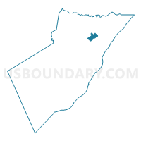
Outline

Summary
| Unique Area Identifier | 617984 |
| Name | Upper township voting district 5 |
| County | Cape May County |
| State | New Jersey |
| Area (square miles) | 3.30 |
| Land Area (square miles) | 3.10 |
| Water Area (square miles) | 0.20 |
| % of Land Area | 94.08 |
| % of Water Area | 5.92 |
| Latitude of the Internal Point | 39.20713470 |
| Longtitude of the Internal Point | -74.68529090 |
Maps


Graphs
Select a template below for downloading or customizing gragh for Upper township voting district 5, Cape May County, New Jersey


Neighbors
Neighoring Voting District (by Name) Neighboring Voting District on the Map
- Dennis township voting district 2, Cape May County, NJ
- Dennis township voting district 8, Cape May County, NJ
- Upper township voting district 10, Cape May County, NJ
- Upper township voting district 11, Cape May County, NJ
- Upper township voting district 15, Cape May County, NJ
- Upper township voting district 4, Cape May County, NJ